![]()
![]()
![]()
![]()
![]()
![]()
Examples of Detail and Accuracy - CDT (All examples are in Montana)
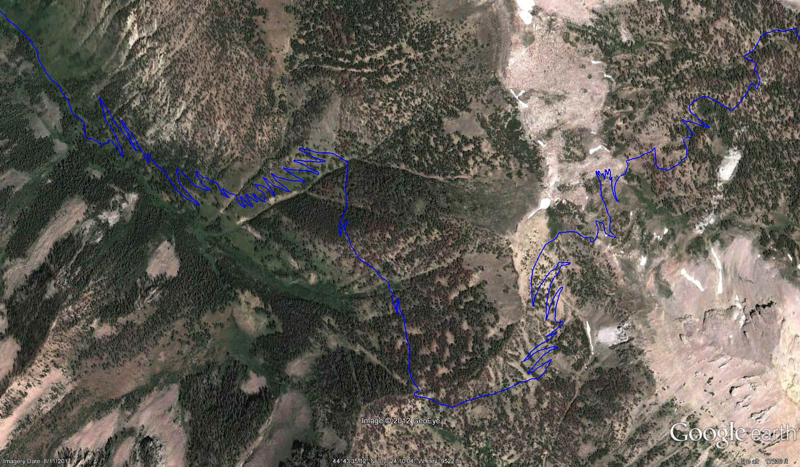
This Google Earth export shows an example of the remarkable detail in the maps. This is a view of a part of Segment 2 showing every turn and switchback. Trail alignments on maps have traditionally been created by finding the trail on aerial photos and guessing those parts not visible.

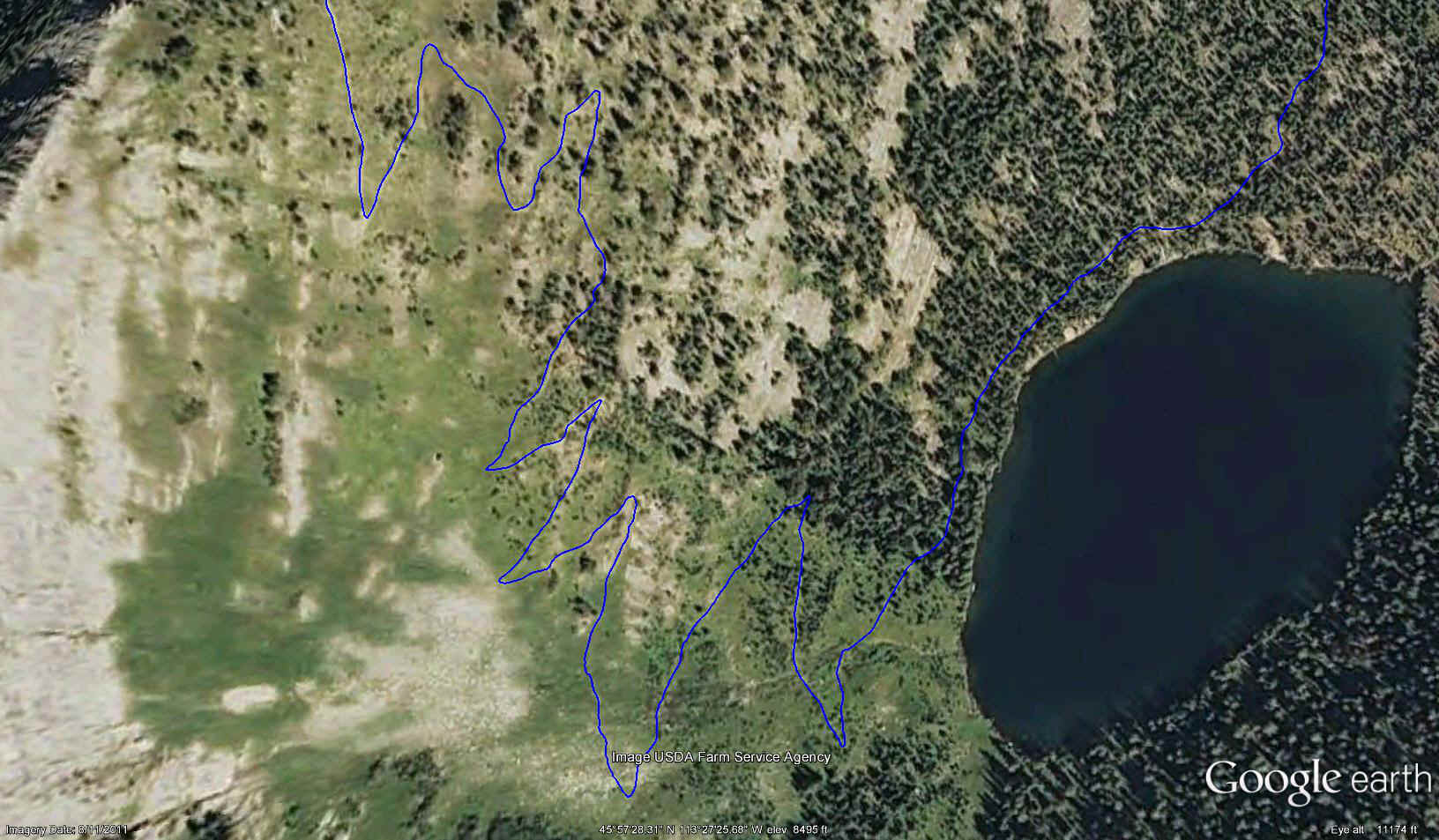
Segment 11. If you look carefully you can see the trail below the line in places.
Segment 15
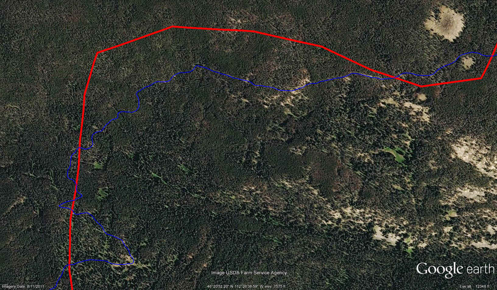
Segment 19. The red line shows the official representation of the trail prior to the mapping project. The blue lines show where the trail actually is as determined by the survey.
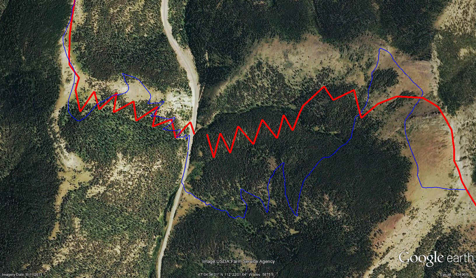
Segment 22. The red line shows the official representation of the trail prior to the mapping project. The blue lines show where the trail actually is as determined by the survey.