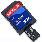
Home Trail Mapping Trail Photos Maps Survey Software Waypoints

Waypoint data, re-routes and updates for The Colorado Trail.

See the section below: Setting up and loading your GPS!

NEW REVISED WAYPOINT LIST   5/2008

Waypoint data is available for manually loading in the Official Colorado Trail Guidebook and in the data book.  

We have created a new waypoint list that reflects all the trail changes through the summer of 2007.  To help offset the cost of maintaining this database and web site for trail users, we are charging a $11 fee for downloading the latest waypoint files for The Colorado Trail.  To get the waypoint data, click on the link below.  This will take you to PayPal where you can pay for the files.  PayPal will notify us, and your waypoint files will be sent to your e-mail address.  The zip file sent will contain the data in Igage All Topo Maps Format, Garmin MapSource formatMagellan MapSend, and GPX formats. The files are all  in NAD83 format.  If your GPS does not use one of the formats above, you may be able to convert these files with the FREE program Babel.  Go to this website and see if yours is supported.   (It probably is.)     

All 1180 waypoints for the trail are included in the files for ease of loading in your GPS. Files are broken down into three files with fewer than 500 waypoints each. 

Click here to purchase the waypoints  ($11) 


Before loading these files in a GPS, be certain that the GPS is set up properly!!  

IMPORTANT INFORMATION!

How to set up and load your gps

Most GPS receivers will not hold the entire waypoint database.  You may need to reload along the trail. 

Memory stick or CD:  Get a memory stick a office supply and install the program you use to load your GPS on it.  Place the waypoint files on it.  You should now be able to run the loading program and load your gps from the memory stick at  internet coffee shops along the way.  If it needs one, be sure to carry the required cable for your gps.  

SD Cards:  (Preferred method) Some of the newer Garmin units utilize SD cards.  Recent versions of Mapsource will load waypoints onto the SD cards.  To do this use the Mapsource Transfer function with no GPS attached to the computer.   Select Transfer>Send To Device> and check the Waypoints box.  Use the Find Device button to locate the SD card on the computer. Transfer the file to the SD card.   When you are ready to load the data,  clear the waypoints from your GPS, turn it off, then turn it back on with the SD card inserted.  The waypoints will load into the GPS and the card can be removed.  Three cards will suffice to load the three furnished files. This has been tested with newer models of the 60CSX and the Coloado 400t, and will probably work on some other models as well. 

Using GPX files without Mapsource:  Many newer gps receivers will accept GPX format data.  To load these files in a Garmin unit that uses SD cards without using Mapsource, follow these steps:  

1.    Place a SD card in your PC and make a directory named Garmin and a subdirectory in it named GPX.

2.    Copy the .gpx file you wish to use to the the \Garmin\GPX\ subdirectory.

3.    Clear the waypoints from the gps, turn it off, and insert the card.  When you turn the gps back on, the waypoints will be copied to the gps.  You can now remove the SD card and replace it with your appropriate Mapsource one if desired – the waypoints will remain until cleared again.  Load additional cards to cover the entire trail.   

POI Files:  Some Garmin units allow the use of POI (Point of interest) files. The advantage of using this feature is that all of the waypoints for the trail may be loaded at one time as POI’s and the waypoint memory is still available for your personal use. The POI’s may be navigated to just like any waypoint, but will only be identified as a point without a label on the gps screen.  (The full point id is still visible in the list view)  They are loaded from the gpx files. 

Garmin provides a free utility that will load these files into your GPS.  Follow this link to get the loader:

http://www8.garmin.com/support/download_details.jsp?id=927


For best results, setup Mapsource and your GPS up the same before loading files:

The native coordinate system for Mapsource and for most gps receivers is WGS84 with a Lat / Long degrees-minutes-decimal minutes display.  All the many other position formats require conversion via formulas programmed into the units.  When you switch from WGS84 to NAD27 in Mapsource or in a GPS a algorithm calculates and displays the new values for positions.  Same when you switch from a Lat / Long format to UTM.  Some users have reported gps conversion errors using Mapsource.  We feel that this is due to multiple conversions going on, and the settings in the gps not matching the settings in Mapsource.  You should be able to avoid all these issues by setting up your Mapsource and GPS receivers to match in the WGS84 system with Lat / Long display before opening any files with Mapsource or transferring any data to the gps. 


Machine loading waypoints from downloaded files:

If you are using Mapsource, make sure that all setups in Mapsource and on the GPS match!  There is a setup in Mapsource under the Edit tab.  Select Edit>Preferences>Position.  Make sure that the Datum setting is set to NAD83 or WGS84.  Set the Position format to one of the Lat / Long options.  Then make sure that the GPS is configured to match.  (NAD83 or WGS84 and identical Lat / Long setting.) Then connect and load the gps receiver or SD card.  Once loaded, you can switch to a different datum in the gps if desired and to UTM.  

The new "The 2008 Colorado Trail Map Book" is configured for NAD83 UTM as well as Lat / Long, so if you are using it, just switch to UTM UPS and leave the Datum setting at WGS84 or NAD83.  If you are trying to match the UTM setting on a USGS Topographic Map, switch the gps Datum setting to NAD27 CONUS (Continental US) and Position format to UTM UPS.  The proper Spheroid setting, if there is one, is Clarke 1866.


MANUAL ENTRY FROM tables in "The Colorado Trail 2008 Map Book"      

    click on image for more information

When you buy a new gps it generally comes from the manufacturer configured for Latitude / Longitude and WGS84.  It will match the data in the new map book exactly.   There is no reason to change the settings unless you want to use the UTM feature and that is fairly straightforward.   

The gps MUST BE SET UP correctly for Units and Coordinate System BEFORE you manually load any waypoint data!!!!!

The data in the Map Book is all NAD83 Format.  

1.    Find and select the "Setup" menu on your GPS.

2.    Find and select the "Units" menu

3.    Set the "Positions Format" to  hdddmm.mmm  (degrees-minutes-decimal minutes) or UTM  This tells the unit what format the data is in before you load it.

4.    Some newer GPS units have settings for both Datum and Spheroid.  You may need to look under both options before you find the one you need.  Set the "Map Datum or Map Spheroid"  to NAD83 or WGS84.  If you are entering Lat / Long data from the tables, set the Position Format to the default degrees-minutes-decimal minutes. (Hdddmm.mmm and Lat / Long)  If you are using UTM, set the setting to  UTM UPS.  (Map Datum will be None  and Spheroid will be WGS84 in some newer units)

5.    Manually enter the data in the the positions format you selected (Latitude / Longitude or UTM).  The data will now match the 2008 Map Book.   

Remember, if the GPS is not set up to match the data format you are entering before entering the data, the gps will not work properly!!  

MANUAL ENTRY FROM tables in "The Colorado Trail official Guidebook" or "Databook"      

The gps MUST BE SET UP for Units and Coordinate System BEFORE you manually load any waypoint data!!!!!

The guidebook and Databook have printed waypoint data.  This data is in NAD27 Datum Format.  

1.    Find and select the "Setup" menu on your GPS.

2.    Find and select the "Units" menu

3.    Set the "Positions Format" to  hddd.ddddd  (decimal degrees)  This tells the unit what format the data is in before you load it.

4.    Set the "Map Datum or Map Spheroid"  to NAD27 and CONUS 

5.    Manually enter the data.  The data will now match the guidebook

.Remember:  Whenever you manually load data in a gps, the data entered MUST match whatever format the gps is configured for.  THEY HAVE TO MATCH or you will be way off!


Cataract Ridge Information. The Colorado Trail was recently re-routed to avoid some motorized sections between Carson Saddle and Elk Creek.  Parts of Segments 23 and 24 are affected.   The new route is still being improved, but is open and official at this time.  A new guidebook will not be printed until the end of the 2008 season, so information is available here about the re-route.   

Cataract Ridge

"The 2008 Colorado Trail Map Book" 

Go to  The Colorado Trail Foundation website. 


Home