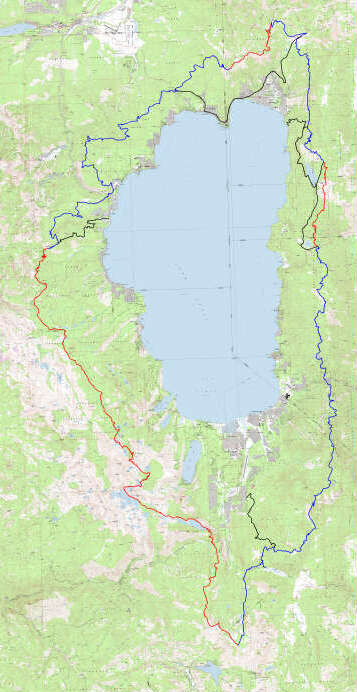
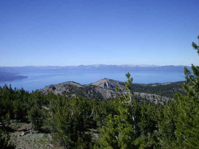
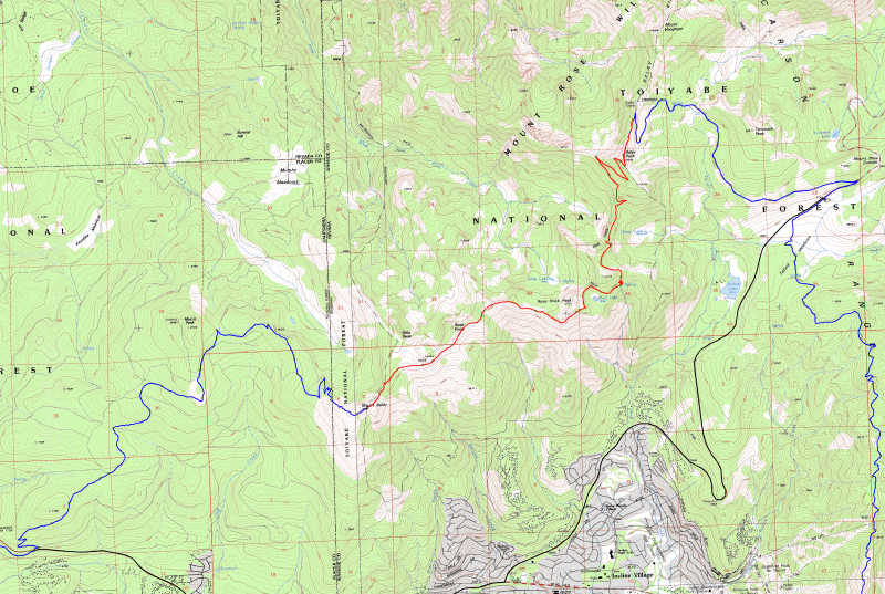
 This is a sky - eye view of the GPS work done to map the TRT. (Click on
image to enlarge) The actual trail is depicted by blue
or red lines. The black lines
indicate bicycle alternate routes. Red
sections are closed to cycling.
This is a sky - eye view of the GPS work done to map the TRT. (Click on
image to enlarge) The actual trail is depicted by blue
or red lines. The black lines
indicate bicycle alternate routes. Red
sections are closed to cycling.Mapping the Tahoe Rim Trail
This is a sky - eye view of the GPS work done to map the TRT. (Click on
image to enlarge) The actual trail is depicted by blue
or red lines. The black lines
indicate bicycle alternate routes. Red
sections are closed to cycling.
On July 29, 2001 we completed the GPS field work for new maps of the +,- 165 miles long route of the Tahoe Rim Trail at beautiful Lake Tahoe, Nevada / California. This spectacular trail encircles Lake Tahoe along high ridges with breathtaking scenery. A total of 51,452 GPS points were observed using Trimble professional grade equipment. The data was post-processed differentially, and was used to plot the maps. Weaker data was culled from the database on the basis of satellite geometry, GPS coverage, and multipath considerations. The resulting database used for the actual mapping contains 32,814 points. The average final spacing for the project is one point every 35 feet.
 (click on images to enlarge)
The official new maps are finished and are now available in CD format. A paper map product is also being developed. The GPS data also covers alternative trails that may be combined with the regular trail to create a 112 mile mountain bike ride. These additional sections include the well known Flume Trail as a bypass to a portion of the main trail that is closed to bicycles, and "Toad's Wild Ride", which exits from section F . We also mapped the Stanford Rock trail and Tunnel Creek. A total of 222 miles of trails and access routes were mapped.
The trail is maintained and supported by The Tahoe Rim Trail Association. These people are great! Follow the link to learn more about the trail and the dedicated group that maintains it. (Or to purchase the CD)
The field part of the project was completed in 15 days. Frank Floyd, who also helped on the Colorado Trail project, and friend Bruce Malone, assisted during the first week. Mark Silver, President of Igage Mapping arrived to provide shuttle while the rest was completed. It took an equal amount of time to differentially correct and post-process the data. The results can only be described as spectacular. Unless you have already seen the Colorado Trail maps, you have probably never seen maps as good as these.
DEM data included in TRT CD The TRT product contains detailed digital elevation modeling data. This represents the first time anyone has combined the full USGS DEM database with a digital map. As a result, it is possible to pick elevations off of the map within a accuracy of 10 feet or so simply by rolling the cursor over the spot you wish to get check.
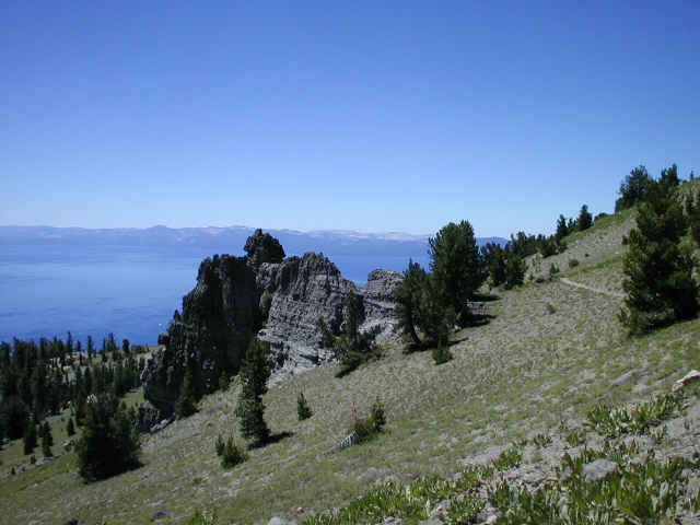
(views from Mt. Rose WA)
We have just completed figuring preliminary mileages for the sections:
The trail is described in a clockwise direction beginning and ending at Tahoe City.
Tahoe City via Stanford Rock and Sec H
19.0
Tahoe City to Brockway
18.9
Road detour to T Meadows
14.6
Tahoe Meadows to Spooner Summit
via Flume Trail / FS
roads
21.4
or: via Sec C to Mile 13.3 and FS roads. (21.3)
Spooner Summit to Kingsbury N
12.2
K. North to K. South on Road
3.5
Kingsbury S. to Big Meadow TH
22.8
Total
112.4
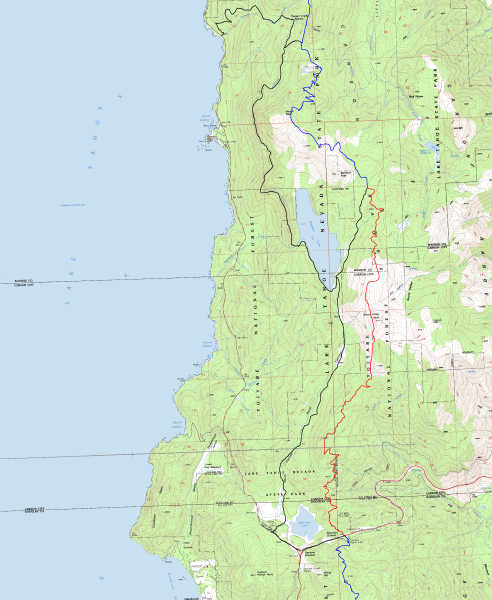
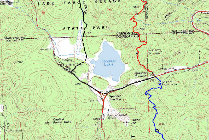
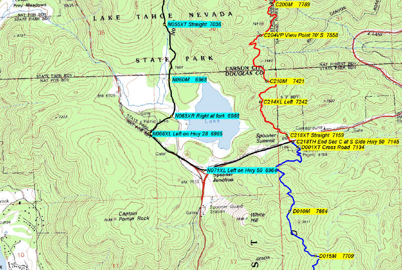
Big View Zoomed Annotated
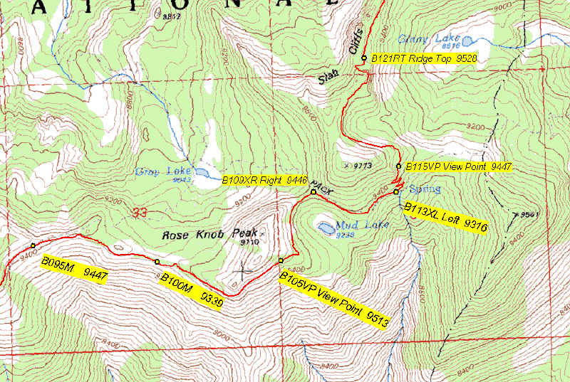
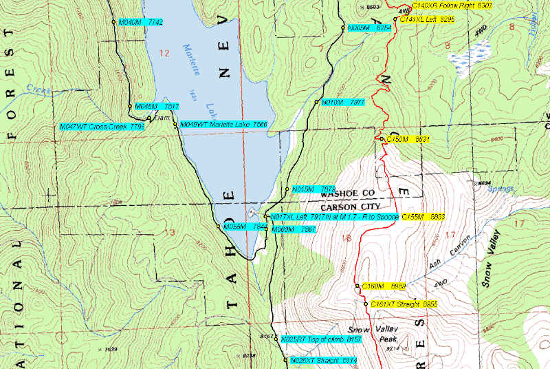
Mt. Rose First map of newly built trail Flume / Marlette Lk / TRT
The samples above show several views of the digital maps. Blue indicates multi-use trails. (open to bicycling at least part of the time) Red indicates trail sections that are restricted to foot and horse traffic only. (always closed to bicycles) Black indicates bicycle detours that avoid the closed areas via alternate trails, fire roads, or highways. These examples are from the Spooner Lake area and the recently completed Mt. Rose Wilderness sections. The waypoint id numbers represent mileages from the start of the segment. "C214XL" (see "Annotated" above) indicates a intersection where a user traveling in a clockwise direction around Lake Tahoe should turn left at mile 21.4 of section 'C'. (see the mileages above for the section letters) The coding allows a user to easily load all the waypoints for the trail into a recreational grade GPS receiver alphabetically by section and mileage. Waypoint data includes such items as trailheads, cross trails, intersections, ridge tops, campsites, and water sources. In addition, when one of these features does not naturally occur, additional waypoints have been included to provide a point approximately every half mile along the entire trail. There are no sections where a user will have to go over a mile without a GPS waypoint. Since these points were actually observed along the trail, they will work in a pocket GPS with a very high reliability and usefulness. The waypoint data will be provided in both digital and printed formats for loading from a PC or manually as needed. A software utility is included to load the data into all the common recreational GPS units. (specific cables are required to hook the units to a PC)
Our GPS equipment, and why we use what we use